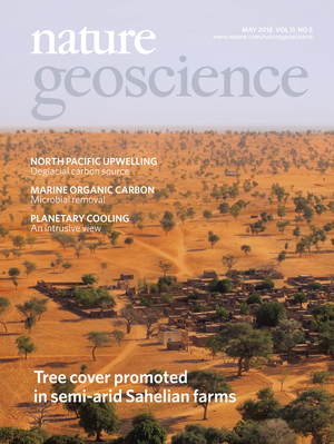
More people equal more trees in semi-arid West Africa - Our new study published in Nature Geoscience questions ‘received wisdom’ as concerns the relationship between human agency and woody vegetation of West Africa. We demonstrate that in low-rainfall areas woody cover is denser in cultivated areas than in savannas, and close to settlements rather that … Continue reading Tree cover promoted in semi-arid Sahelian farms – new publication in Nature Geoscience
Tag: Sahel
Integrating meteorological data in biomass prediction models
Diouf, A.A.; Hiernaux, P.; Brandt, M.; Faye, G.; Djaby, B.; Diop, M.B.; Ndione, J.A.; Tychon, B. Do Agrometeorological Data Improve Optical Satellite-Based Estimations of the Herbaceous Yield in Sahelian Semi-Arid Ecosystems? Remote Sens. 2016, 8, 668. Quantitative estimates of forage availability at the end of the growing season in rangelands are helpful for pastoral livestock … Continue reading Integrating meteorological data in biomass prediction models
Recent woody vegetation trends in Sahel
Our new paper looks at recent dynamics in woody vegetation in Sahel and finds some interesting patterns which are mainly controlled by human population density. Martin Brandt, Pierre Hiernaux, Kjeld Rasmussen, Cheikh Mbow, Laurent Kergoat, Torbern Tagesson, Yahaya Ibrahim, Abdoulaye Wele, Compton J. Tucker, Rasmus Fensholt. Assessing woody vegetation trends in Sahelian drylands using MODIS … Continue reading Recent woody vegetation trends in Sahel
Remote sensing of vegetation in drylands: Evaluating vegetation optical depth (VOD) using NDVI and in situ data over Sahel
Tian, F.; Brandt, M.; Liu, Y. Y.; Verger, A.; Tagesson, T.; Diouf, A. A.; Rasmussen, K.; Mbow, C.; Wang, Y.; Fensholt, R. Remote sensing of vegetation dynamics in drylands: Evaluating vegetation optical depth (VOD) using AVHRR NDVI and in situ green biomass data over West African Sahel. Remote Sensing of Environment 2016, 177, 265–276. … Continue reading Remote sensing of vegetation in drylands: Evaluating vegetation optical depth (VOD) using NDVI and in situ data over Sahel
AGU 2015
We had three presentations at this years AGU fall meeting in San Francisco. Find the posters and presentations as PDFs here (the copyright is with the authors): Feng Tian, Martin Brandt, Yi Liu, Rasmus Fensholt. Remote sensing of biomass dynamics in drylands: Evaluating vegetation optical depth (VOD) using AVHRR NDVI and in situ data. AGU … Continue reading AGU 2015
Woody plant cover estimation in drylands from Earth Observation based seasonal metrics
Brandt, M., Hiernaux, P., Tagesson, T., Verger, A., Rasmussen, K., Diouf, A.A., Mbow, C., Mougin, E., Fensholt, R., 2016. Woody plant cover estimation in drylands from Earth Observation based seasonal metrics. Remote Sensing of Environment 172, 28–38. Download a free copy here (until 28 December 2015) . Trees, shrubs and bushes are an important element … Continue reading Woody plant cover estimation in drylands from Earth Observation based seasonal metrics
Fodder Biomass Monitoring in Sahelian Rangelands Using Phenological Metrics from FAPAR Time Series
From: Diouf, A.A., Brandt, M., Verger, A., Jarroudi, M.E., Djaby, B., Fensholt, R., Ndione, J.A., Tychon, B., 2015. Fodder Biomass Monitoring in Sahelian Rangelands Using Phenological Metrics from FAPAR Time Series. Remote Sensing 7, 9122–9148. doi:10.3390/rs70709122 Livestock farming constitutes the most widespread human activity and the dominant land use in rangeland ecosystems. At a global … Continue reading Fodder Biomass Monitoring in Sahelian Rangelands Using Phenological Metrics from FAPAR Time Series
What Four Decades of Earth Observation Tell us about Land Degradation in the Sahel
From: Mbow, C.; Brandt, M.; Ouedraogo, I.; de Leeuw, J.; Marshall, M. What Four Decades of Earth Observation Tell Us about Land Degradation in the Sahel? Remote Sens. 2015, 7, 4048-4067. Land degradation mechanisms are related to two main categories, one related to climate change and one associated with local human impact, mostly land use … Continue reading What Four Decades of Earth Observation Tell us about Land Degradation in the Sahel
Be cautious using GIMMS3g v0 for trend analysis!
GIMMS3g NDVI is widely used to assess vegetation trends from local to global scale. And even though it is the best long term dataset available right now (July 2015), people should be aware that a serious error affects the dataset in semi arid areas, like the Sahel, which has severe impacts on trend analysis. The … Continue reading Be cautious using GIMMS3g v0 for trend analysis!
Ground- and satellite-based evidence of the biophysical mechanisms behind the greening Sahel
Making use of 27 years of ground measurements, we were able to find evidence of the role of trees and grass on the greening of the Senegalese Sahel. This was made possible by a close collaboration with our colleagues from the CSE, the Centre de Suivi Ecologique in Dakar. Moreover, woody species abundance data provided … Continue reading Ground- and satellite-based evidence of the biophysical mechanisms behind the greening Sahel


