Here's a simple way of processing MODIS: downloading, extracting the bands from HDF as GEOTIFF, merging tiles and reprojecting. Area extraction, NDVI calculation, cloud filtering and more can be done in GRASS for example. It's Linux based, but can easily used in Windows. My way might not be the most elegant, but it's fast and … Continue reading Downloading and processing MODIS with fast and free tools
Tag: MODIS

Recent woody vegetation trends in Sahel
Our new paper looks at recent dynamics in woody vegetation in Sahel and finds some interesting patterns which are mainly controlled by human population density. Martin Brandt, Pierre Hiernaux, Kjeld Rasmussen, Cheikh Mbow, Laurent Kergoat, Torbern Tagesson, Yahaya Ibrahim, Abdoulaye Wele, Compton J. Tucker, Rasmus Fensholt. Assessing woody vegetation trends in Sahelian drylands using MODIS … Continue reading Recent woody vegetation trends in Sahel

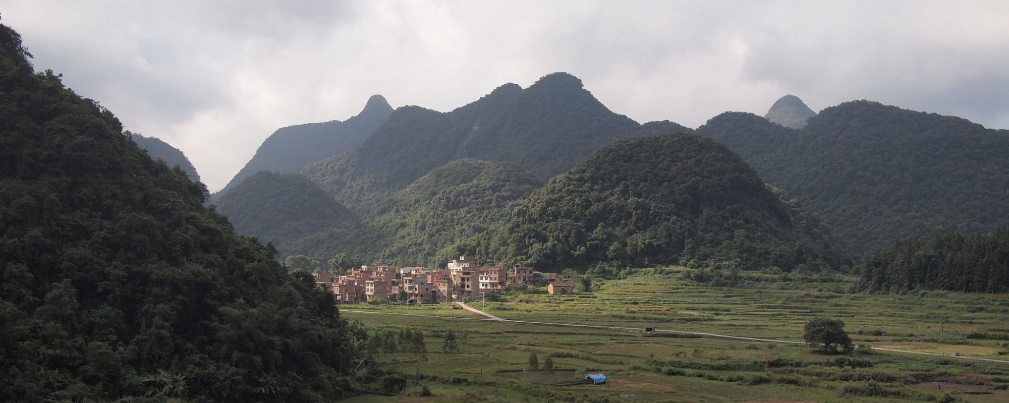
Assessing Future Vegetation Trends and Restoration Prospects in the Karst Regions of Southwest China
Our latest article is not located in the Sahel, however, the method to assess the future persistence of vegetation trends is highly interesting in the context of ecosystem stability and resistance. The article is open access and freely available. Tong, Xiaowei; Wang, Kelin; Brandt, Martin; Yue, Yuemin; Liao, Chujie; Fensholt, Rasmus. 2016. "Assessing Future Vegetation … Continue reading Assessing Future Vegetation Trends and Restoration Prospects in the Karst Regions of Southwest China
Renaming, converting, clipping: script based raster time series processing
When working with remotely sensed time series data (e.g. MODIS, AVHRR, GIMMS, etc.), bulk processing can save a lot of time. Using a terminal in a Linux environment, simple scripts can process thousends of files in short time. Here are some basic hints on how to start, gdal has to be installed. For Windows users … Continue reading Renaming, converting, clipping: script based raster time series processing

Simple time series analysis with GIMMS NDVI and R
Time series analysis with satellite derived greenness indexes (e.g. NDVI) is a powerfull tool to assess environmental processes. AVHRR, MODIS and SPOT VGT provide global and daily imagery. Creating some plots is a simple task, and here is a rough start how it is done with GIMMS NDVI. All we need is the free software … Continue reading Simple time series analysis with GIMMS NDVI and R

Detecting environmental change using time series, high resolution imagery and field work – a case study in the Sahel of Mali
Climatic changes and population pressure have caused major environmental change in the Sahel during the last fifty years. Many studies use coarse resolution NDVI time series such as GIMMS to detect environmental trends; however explanations for these trends remain largely unknown.We suggest a five-step methodology for the validation of trends with a case study on the Dogon Plateau, … Continue reading Detecting environmental change using time series, high resolution imagery and field work – a case study in the Sahel of Mali
