From: Mbow, C.; Brandt, M.; Ouedraogo, I.; de Leeuw, J.; Marshall, M. What Four Decades of Earth Observation Tell Us about Land Degradation in the Sahel? Remote Sens. 2015, 7, 4048-4067. Land degradation mechanisms are related to two main categories, one related to climate change and one associated with local human impact, mostly land use … Continue reading What Four Decades of Earth Observation Tell us about Land Degradation in the Sahel
Tag: GIMMS
Renaming, converting, clipping: script based raster time series processing
When working with remotely sensed time series data (e.g. MODIS, AVHRR, GIMMS, etc.), bulk processing can save a lot of time. Using a terminal in a Linux environment, simple scripts can process thousends of files in short time. Here are some basic hints on how to start, gdal has to be installed. For Windows users … Continue reading Renaming, converting, clipping: script based raster time series processing
Pixel-wise time series trend anaylsis with NDVI (GIMMS) and R
The GIMMS dataset is currently offline and the new GIMMS3g will soon be released, but it does not really matter which type of data is used for this purpose. It can also be SPOT VGT, MODIS or anything else as long as the temporal resolution is high and the time frame is long enough to … Continue reading Pixel-wise time series trend anaylsis with NDVI (GIMMS) and R
Simple time series analysis with GIMMS NDVI and R
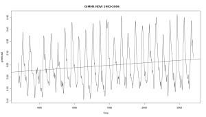
Time series analysis with satellite derived greenness indexes (e.g. NDVI) is a powerfull tool to assess environmental processes. AVHRR, MODIS and SPOT VGT provide global and daily imagery. Creating some plots is a simple task, and here is a rough start how it is done with GIMMS NDVI. All we need is the free software … Continue reading Simple time series analysis with GIMMS NDVI and R
Detecting environmental change using time series, high resolution imagery and field work – a case study in the Sahel of Mali
Climatic changes and population pressure have caused major environmental change in the Sahel during the last fifty years. Many studies use coarse resolution NDVI time series such as GIMMS to detect environmental trends; however explanations for these trends remain largely unknown.We suggest a five-step methodology for the validation of trends with a case study on the Dogon Plateau, … Continue reading Detecting environmental change using time series, high resolution imagery and field work – a case study in the Sahel of Mali


